Building a Community Through Conservation
Combining Science, Planning, and People for a Shared Vision of a Healthier Future
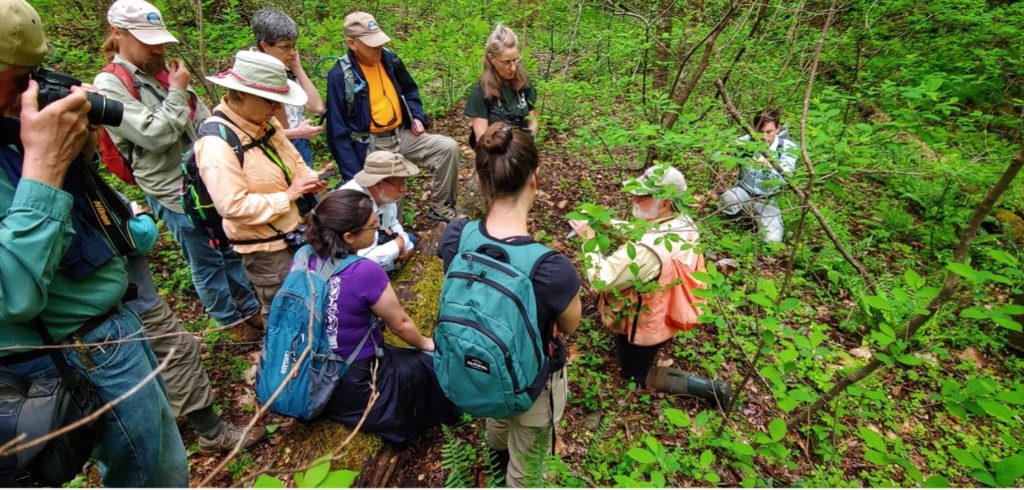
Effective conservation is not driven by research alone—it functions best as a collaborative effort between researchers, partner organizations, local and state government agencies, and an informed public. By inviting community members and leaders to pose questions and exchange knowledge about conservation, scientists can produce research that is more relevant, credible, and perhaps most importantly—applicable—to those communities. This transparency and refining of results can then lead to more robust community support for land and resource management decisions that can improve ecosystem function and health
Given the importance of connecting a diverse community of people to conservation efforts, researchers need to also build out diverse methods for engaging them. This article will highlight a few examples of engagement strategies used by scientists at the Changing Landscapes Initiative (CLI), Rappahannock Working Land & Seascapes (RappWLS), and Virginia Working Landscapes (VWL) that have allowed researchers and local communities to work more effectively together towards a more sustainable future. To find out more about the teams and individuals that make this work possible, please review the list of supporters and collaborators at the end of this piece.
Community Engagement Across Northern Virginia
The three Smithsonian programs featured in this piece work within Northern Virginia, spanning eastwards from George Washington National Forest to Shenandoah National Park, and across the Piedmont to the Chesapeake Bay. See the above map for more information about where their study areas are located.
Use the map here to see the areas each program works in and click the links below to jump to the respective sections
Changing Landscapes Initiative
The Changing Landscapes Initiative (CLI): Gathering Community Knowledge to Inform Research
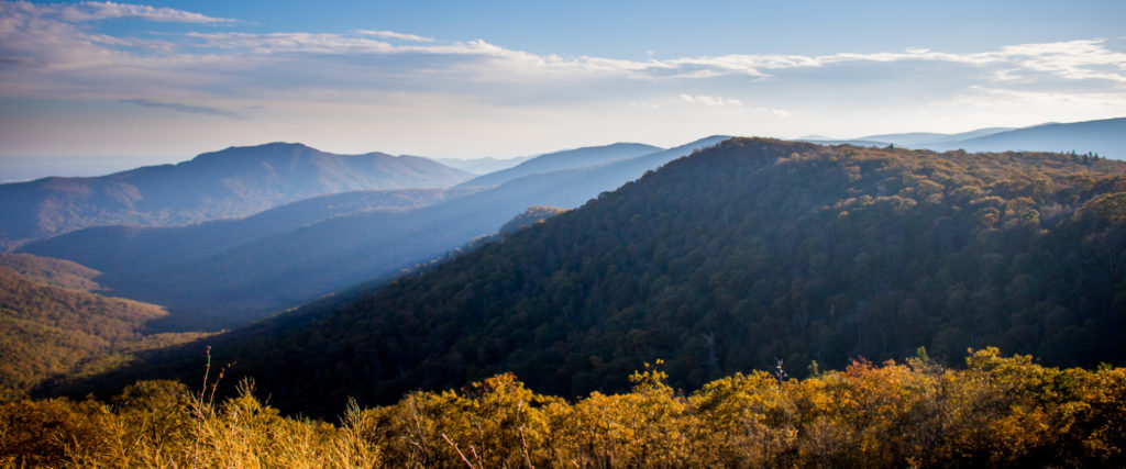
The Changing Landscapes Initiative (CLI), a program of the Smithsonian’s National Zoo and Conservation Biology Institute (NZCBI), combines Smithsonian research with community wisdom to secure a healthy future for people and wildlife. Two key moments in CLI’s engagement efforts were a pair of scenario planning workshops held at the start of a land use modeling effort. For these meetings, CLI researchers invited influential community members including land use planners, local conservation advocates, and land managers. During the workshops, researchers asked the participants to draw from their lived experiences to create written narratives about their lives under four distinct scenarios of future land use change. Through this narrative building process, participants could express their expertise on local needs and fears, technical and economic realities, and their desires for community well-being.
Importantly, while participants were asked questions of a particular interest to the CLI team, they were also given ample space to provide insight researchers had not considered. For example, to envision the future more clearly, participants were asked to close their eyes and imagine they were standing on top of a mountain. After visualizing the landscape 50 years into the future, they were asked to sketch what they saw. By sharing their drawings in a workshop setting, participants could further explore the ideas behind their imagined future landscapes, find out how others relate to them, and then articulate their insights to the researchers. After the workshops, the CLI researchers incorporated the shared responses and observations into their research to develop tools that can project future landscapes.
A few examples of these community-generated visuals and descriptions are shown below:

The above sketch reflects another participant’s visualization of a potential future scenario. Their projection was less optimistic, describing the landscape as “More invasive plant species, loss of endangered species, peppered lights, manicured main streets, elimination of sky night views, more haze.”

This sketch is a visual representation of a possible future in the Shenandoah Valley region. The participant described this potential future landscape as “Productive, rain-fed agriculture that supports nearby population centers (DC, Baltimore, Charlottesville, Northern Virginia).”
Rappahannock Working Land and Seascapes (RappWLS): Creating Visuals for Better Outreach Efforts
Rappahannock Working Land and Seascapes (RappWLS), a project of the Smithsonian’s Working Land & Seascapes program, aims to examine how land use change impacts biodiversity and ecosystem services on the land and in the waters within and fed by the Rappahannock River Watershed. One of their ongoing research priorities, led by the Fisheries Conservation Lab at the Smithsonian Environmental Research Center, is the study of oyster reef structure, function, and quality in order to inform evaluations of oyster restoration efforts.
Because healthy oyster reefs support staple seafood species like blue crabs and black seabass, they play an important role in the Chesapeake Bay region’s economy and culture. Unfortunately, more than 85% of the world’s oyster reefs have disappeared, prompting governments and community organizers to conduct multiple restoration efforts. To engage with these passionate groups, the Fisheries Conservation Lab researchers have turned to new visual recording and communication technologies.
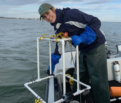
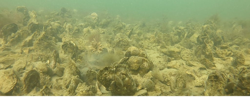
First, researchers developed an easy-to-build survey tool by attaching waterproof video cameras to a PVC frame. Surveyors simply drop the frame from a boat to capture a close-up view of the oyster habitat hidden under often murky waters. They then retrieve the frame and analyze the images back on land. Because this survey technique doesn’t require trained SCUBA divers to collect, count, and measure individual oysters it can also be used by local restoration and survey groups.
The same videos and images used to collect data also serve as striking visual products which can then be shared with partners and the public to bring them into the oysters’ habitats and see the wide variety of other aquatic species that call this habitat home. One of the key platforms for sharing these images is the online Chesapeake Reefs StoryMap. Here, readers can explore an interactive map that places each survey image where it was captured. In this way, the community can zoom in to find the actual oyster reefs found near their homes, fishing spots, or other favorite local waterways. Together, the interactive maps and cameras are exciting outreach tools that help to bring oysters and people together.

Virginia Working Landscapes (VWL): Collaborating for Conservation Action
Virginia Working Landscapes (VWL) is a program of the Smithsonian’s National Zoo and Conservation Biology Institute that promotes the conservation of native biodiversity and sustainable land management through scientific research, education, and community engagement. After spending more than a decade researching plant, pollinator, and bird communities on working lands in Virginia, the program looked to build a team of collaborators to increase their capacity for turning those research results into effective on-the-ground conservation action.
There are more than 50 species of birds in Virginia that rely on grasslands for breeding, nesting, and foraging, and most of the state’s remaining grasslands are privately owned. VWL conducts its research primarily on these private landscapes, and uses a robust network of landowners, producers, researchers, and community scientists to study and mitigate recent declines in grassland bird populations. To expand the reach of these efforts, VWL started brainstorming with The Piedmont Environmental Council (PEC), an accredited land trust with strong ties to landowners and producers in the region. Together, they identified ways to combine their local expertise and amplify grassland bird conservation on working lands. Recognizing a need for more collaboration, these two groups brought on American Farmland Trust (AFT) and Quail Forever (QF) as lead partners and launched the Virginia Grassland Bird Initiative (VGBI).
The combined capacity and expertise of these four organizations allows VWL to leverage their resources and turn research findings into sustainable conservation practices that protect grassland birds on working lands. VWL contributes their conservation research and a network of academic partners, community science volunteers, and landowners. PEC brings their land stewardship expertise and their own landowner community. AFT provides a deep knowledge of regenerative agricultural practices and a history of working closely with producers in the region. QF is a leader in upland habitat conservation, an NRCS partner, and has close ties to the hunting and outdoors community. Together they can reach a far broader audience than they could working alone. Now, through this strongly interconnected conservation community, VWL and its VGBI partners aim to make a lasting difference for farmers and birds throughout Virginia’s northern Piedmont, Blue Ridge, and Shenandoah Valley.
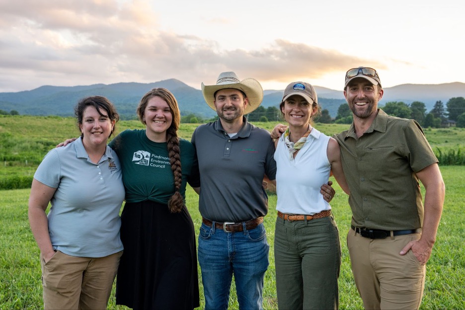
Meet the Virginia Grassland Bird Initiative Team! From left to right: Celia Vuocolo, Private Lands Biologist (Quail Forever), October Greenfield, VGBI Co-Coordinator (The Piedmont Environmental Council), Jacob Gilley, Mid-Atlantic Sustainable Grazing Manager (American Farmland Trust), Amy Johnson, Program Director (Smithsonian’s Virginia Working Landscapes), and Justin Proctor, VGBI Coordinator (Smithsonian’s Virginia Working Landscapes); photo by Hugh Kenny, The Piedmont Environmental Council.
Conclusion
The examples presented from these programs represent just a small sampling of the ways conservation scientists and advocates are working to more fully engage with the community their studies serve. Here are a few possible takeaways to consider:
- Learning from Lived Experience
Understanding who local stakeholders are, where they’re coming from, and their connection to the issue can lead to more informed research plans that produce more applicable outcomes with a much higher chance of being used for conservation actions.
- Using Technology for Research and Outreach
New technologies can provide scientists with creative ways to make their work more accessible, both to invested community members looking to contribute directly, and broader communities that can follow along from the comfort of their homes.
- Strengthening Partnerships for Greater Reach and Impact
Uniting multiple organizations and partners under a single cause can help amplify shared conservation goals and translate them into concrete action. Collaborations can also strengthen outreach efforts by expanding target networks and drawing from different areas of expertise.
The Changing Landscapes Initiative is supported by the Smithsonian’s Environmental Research Center, Piedmont Environmental Council, the Appalachian Trail Conservancy, USGS, the Shenandoah National Park Trust, the Shenandoah Valley Network, Virginia Tech, the Virginia Native Plant Society, the Washington Biologists’ Field Club, Working Land & Seascapes, and the researchers and citizen scientists at eMammal and Virginia Working Landscapes.
Rappahannock Working Land & Seascapes (RappWLS) is a subproject of the Smithsonian’s Working Land & Seascapes project. The RappWLS team is made up of a diverse range of scientists with expertise on the land and in the waters of the Rappahannock watershed. Research collaborators include Dr. Allison Tracy, Matthew Ogburn & Fisheries Conservation lab members; Kim Komatsu; Amy Hruska; Zofia Knorek; Dr. Amy Johnson; Katrina Lohan, and the Smithsonian Working Land and Seascapes. The organizations and stakeholder groups involved with the research include the Severn River Association, the Chesapeake Bay Foundation, The Maryland Department of Natural Resources, the National Oceanic and Atmospheric Administration (NOAA), aquaculture professionals, and wild harvest watermen.
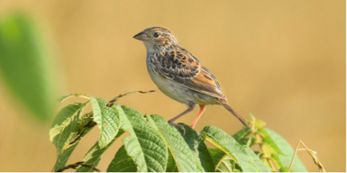
Grasshopper Sparrow populations have declined by over 70% due to habitat loss, fragmentation, and degradation. However, these sparrows have been found to positively respond to land management regimes such as prescribed burning, delayed mowing, and light grazing; photo by Bernadette Rigley.
Virginia Working Landscapes (VWL) is supported 100% by grants and donations, and their work is made possible by the generous contributions from their community. Click here to find out how you can help support VWL’s mission.
The Virginia Grassland Bird Initiative was founded by The Piedmont Environmental Council and the Smithsonian’s Virginia Working Landscapes. Lead collaborators include the American Farmland Trust and Quail Forever.
